Pumps, Troughs and Capped Wells: A Water Walk Round Stow's Back Lanes
Stow is a hill town, and hill towns have a problem. Stand on the Square on a wet November morning and you can watch the rain arrive from three directions at once, running off the slate and the stone and heading downhill fast — away from the people who need it. For most of its history, this was a place that had plenty of water passing through and not much of it stopping.
That's the thing to hold in your head as you walk this route. Every pump, trough and stone-lined shaft you pass is an answer to the same question: how do you keep a market town on a hill supplied? Some of those answers are still visible. Some were capped, filled or quietly built over. All of them are within about a mile of the Cross.
Before you set off
This is a short one — roughly two miles, an hour and a half at a pottering pace, and almost all of it on paved lanes, trods and level churchyard paths. There's one pull back up to the Square at the end, which is the only bit that will make you breathe. Trainers are fine in dry weather; after a wet week, go for boots, because a couple of the back lanes hold water in a way that suggests they always have.
Bring nothing special. A torch is handy if you like peering into dark corners, and a bit of patience for the fact that most of what you're looking for is behind a wall.
Start at the Cross and think downhill
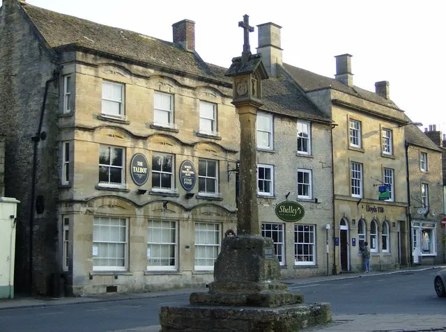
Stand at the Cross in the middle of the Square and look for the lowest ground you can see. That's the direction water goes, and it's the direction we're going — but slowly, and with detours.
Stow grew up here because of sheep and wool, not because of a river, and the town's water supply was always a patchwork. There were wells in gardens and yards, pumps on corners, rainwater butts off every downpipe, and a set of public taps that arrived late and were treated, at first, as a bit of a novelty. Anyone who has lived in a Cotswold stone house will recognise the pattern: you take what falls on the roof, and you send someone with a bucket for the rest.
Head down Digbeth Street, and keep your eyes off the shop windows for a moment. This is the town's old approach from the east, and the gutters and kerb lines here tell you a lot about how water was channelled — not so much a drainage system as a series of gentle suggestions.
The troughs and the street furniture
Halfway down you'll pass the sort of stone trough that gets photographed by people who think it's a planter. It isn't — or it wasn't. Troughs like this served animals first: drovers' dogs, cart horses, the sheep that made the town's fortune. Stow was a market town with a huge sheep trade, and a beast market needs water as much as it needs pens.
Many of these troughs were fed by a small pipe from a spring or a cistern uphill, and when the supply was cut off in the age of mains water, they simply became decorative. Look for the staining on the inside. Iron in the water leaves a rust-coloured tide line, and you can often see how high the water used to sit.
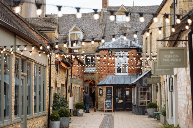
Carry on towards the church, but before you reach it, take a moment in any of the little passages that run off the main street. The damp patches on the lower courses of the walls — darker stone, greener mortar — are a decent map of where water still seeps. That's not decay, by the way. Lime mortar and Cotswold stone are designed to let moisture move through and dry out. It's when a wall is sealed with cement render that the water has nowhere to go and starts eating the stone from inside.
Up to the churchyard and the wells behind walls
The area around St Edward's is the best place in town to see what a well looks like when it's been politely retired. In several of the gardens and boundaries nearby there are capped shafts — a circle of stone under a slab, sometimes a low iron cover, sometimes just a change in the paving that says something is under here.
Ask a local about them and you'll get a version of the same story: the well was in use within living memory of somebody's grandmother, then it went brackish, or the pump seized, or mains water arrived and the whole thing became a liability with a child in the house. Capping was the sensible answer. There are dozens of them across the town, and most are marked by nothing more than a slight dip in a lawn.
Look out, too, for the older hand pumps — the tall iron kind with a curved handle. A few survive on private walls. You won't be able to work them, and you shouldn't try, but they're a useful reminder that 'running water' in a Victorian Cotswold household meant somebody running out to fetch it.
Back Walls and the damp side of town
Come back round via Back Walls and the lanes behind the main streets. This is the low, shady, north-facing side of things, and it's where the town stays wet longest. You'll notice moss on the tops of walls, ferns in the joints, and gutters that are doing their best.
This is the stretch where the walk stops being about history and starts being about buildings. Stow's old houses sit on shallow foundations in ground that holds moisture, and the ones that survive best are the ones where water was managed: gutters cleared, ground levels kept below the damp course, drains kept open. When you see a stone plinth running along the bottom of a facade, that's not ornament. That's a barrier.
It's also why so many of the town's older walls lean. Wet ground shifts, and a wall built without deep footings will follow it. The lean is usually stable and usually old — but it's a good reason not to lean on garden walls while you're admiring them.
The short version, if you're in a hurry
- Distance: about two miles, one gentle climb back to the Square.
- Time: 90 minutes with stops; 45 if you march.
- Best light: mid-morning, when the sun gets into the back lanes.
- Worst conditions: after three days of rain, when the lower lanes are more stream than street.
- Don't: climb gates, lift covers, or work any pump you find. They're old, and some of them are somebody's water supply.
Finishing up
Water walks build a thirst, which feels like the right sort of symmetry. The Square is two minutes away and there's no shortage of places to sit down — and if you've come in 2026 expecting to find a village pump on every corner with a plaque on it, you'll be disappointed. Stow's water history is quieter than that. It's a dip in a lawn, a rust line in a trough, a green stain on a wall.
Which is rather the point. The best thing about this walk is that it doesn't ask you to look at anything special. It asks you to notice that a town on top of a hill has spent several hundred years being clever about water — and that it's still doing it, every time a gutter gets cleared.